59° and Overcast
Image
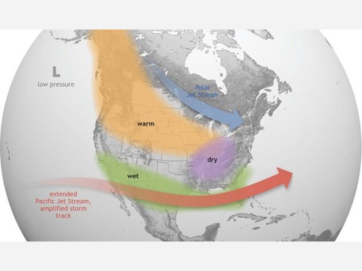
El Niño causes the Pacific jet stream to move south and spread further east. Source: NOAA National Ocean Service "What are El Niño and La Niña?"



El Niño causes the Pacific jet stream to move south and spread further east. During winter, this leads to wetter conditions than usual in the southern U.S. and warmer and drier conditions in the north. Source: NOAA National Ocean Service "What are El Niño and La Niña?" (https://oceanservice.noaa.gov/facts/ninonina.html).
The California Department of Conservation defines "El Niño is the “warm phase” of the El Niño-Southern Oscillation and features warmer than average ocean surface temperatures off the coast of Ecuador and Peru in the equatorial eastern Pacific Ocean."
The NOAA Climate Prediction Center provides a monthly update on ENSO conditions
Seasonal to sub-seasonal temperature and precipitation outlooks are available from the NOAA Climate Prediction Center at https://www.cpc.ncep.noaa.gov/products/predictions/WK34/.
If rainfall trends above average, or if multiple storms occur back-to-back, the risk of overly saturated rock and soil on steep slopes increases the risk of landslides and debris flows. Please refer to the CGS Landslides page (https://www.conservation.ca.gov/cgs/landslides) for more information about landslides and landslide hazards in California.


Sunny, with a high of 67 and low of 57 degrees. Overcast for the morning, moderate rain in the afternoon, light rain shower for the evening, clear overnight.